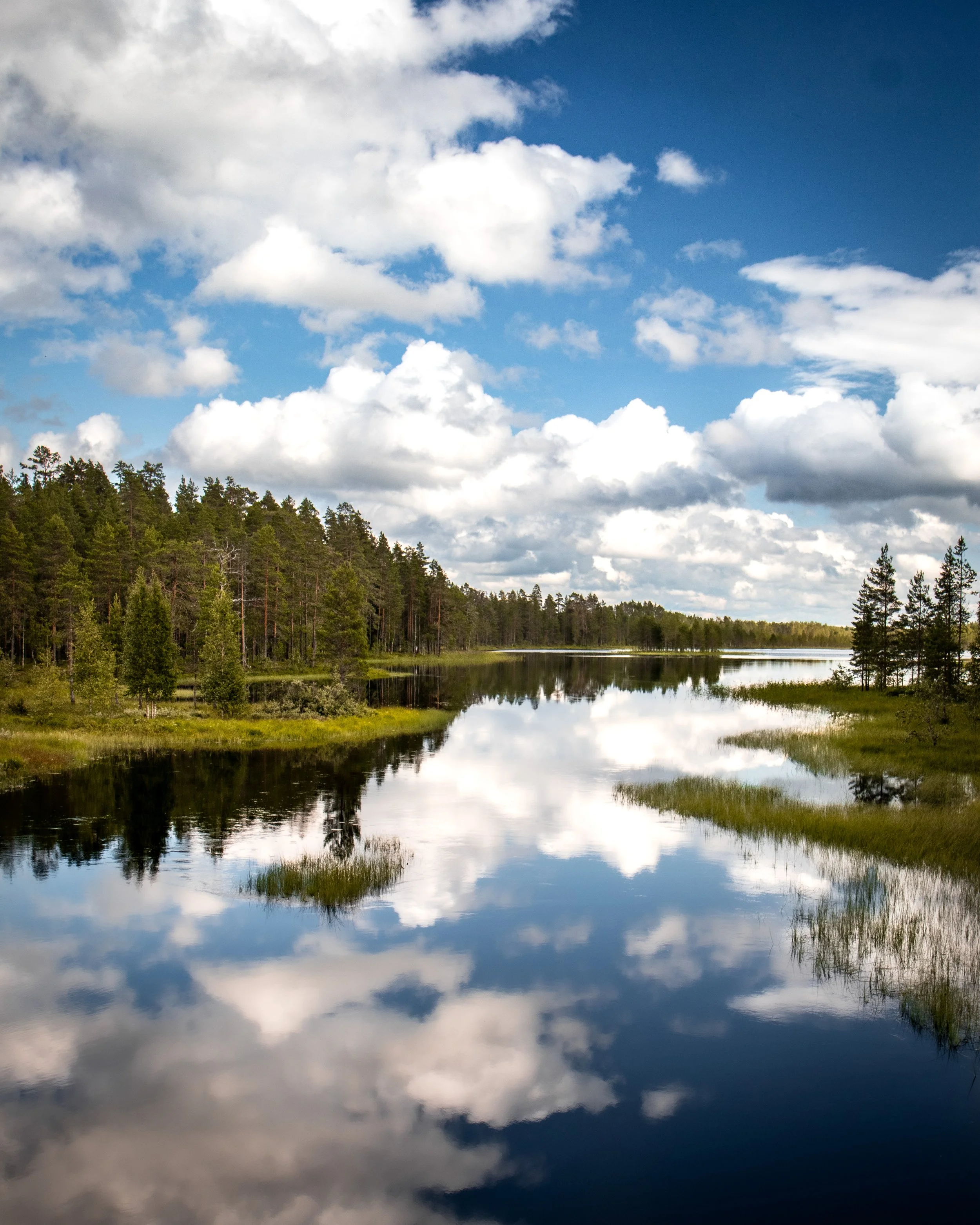
Tiilikkajärven kansallispuisto / Tiilikkajärvi National Park
Minun mummola sijaitsee Sotkamossa ja aina sinne ajaessa olen katsonut Tiilikkajärven kansallispuiston kylttiä ja ajatellut, että milloinkohan tuonne kerkeäisi. Meidän mummola reissut on yleensä sen verran hektisiä, paljon sukulaisia nähtävänä ja paljon tekemistä, että vaelluksille ei kyllä kerkeä. Noh, tänä kesänä sitten vihdoin kerkesikin ja iso kiitos siitä kuuluu kummitädilleni joka haki minut Sotkamosta ja lähti vaellusseuraksi.
// My Grandma lives in Sotkamo and I’ve always looked at the Tiilikkajärvi National Park sign when driving to Sotkamo and thinking about when I will be able to go there. Our trips to my Grandma’s are usually quite hectic, with a lot of relatives and a lot to do, so there has never been time for any hikes. Well, now was the time thanks to my Godmother who picked me up from Sotkamo and went hiking with me.


Tällä seudulla oli satanut joka päivä jo pidemmän aikaa ja vielä aamullakin tuli vettä, mutta iltapäiväksi oli kuitenkin luvattu poutaa ja jopa hetkittäin aurinkoa. JESS! Auto sai jäädä isolle parkkipaikalle, Sammakkotammen opastuspaikalle (Valtimontie 1095, Rautavaara) josta lähdimme kiertämään Uiton kiertoa (7km). Uiton kierto kiertää kaksi järveä. Sen lisäksi sain taas nauttia omasta suosikistani eli suomaisemasta ja upeista mäntymetsistä. Kierros ei ole raskas, sillä nousuja on hyvin vähän, mutta polulla on paljon kiviä ja juuria.
// It had been raining in this region for weeks and it was even raining in the morning, but the afternoon was looking better and the sun could even make an appearance. Yaas! We left the car at a big parking lot at Sammakkotammi (Valtimontie 1095, Rautavaara) and started our Uiton kierto (7 km) hike. This hike went around two lakes. I also got to enjoy my favorite landscape, the mires, and beautiful pine tree forests. This hike wasn’t that strenuous, but there are a lot of rocks and roots on the path.


Me halusimme nähdä paljon puhutun Venäjänhiekan eli upean pitkän hiekkarannan. Pidimme evästauon Venäjänhiekalla ja päätimme käydä vielä Kalmoniemen kärjessä kääntymässä, sillä hyvin kapea niemi näytti houkuttelevalta. Kalmonniemen kärjestä pääsee yli Pohjoisniemeen ylitysveneellä. Uiminen alkoi toden teolla houkuttelemaan sillä hiekkarantoja oli vähän siellä sun täällä. Harmi vain, että keli ei ollut mitenkään erityisen lämmin ja vesi tuntui kylmältä.
// We wanted to see the well known beach called Venäjänhiekka (eng. Russiansand). It is a long finely grained sand beach. We had a little picnic at the beach and decided to take our hike to the point of the narrow Kalmonniemi peninsula. You can take a crossover boat from here if you want to make your hike longer. We really got eager to swim as there were a lot of beautiful sand beaches everywhere you looked. Too bad that it wasn’t that warm and the water felt really cold.


Kierroksella mennään kolmen erilaisen, mutta upean sillan yli. Itselläni oli lenkkarit jalassa, kun en ollut varautunut tähän vaellukseen. Ne pysyivät kuivina lähes koko kierroksen, mutta loppumatkasta oli niin märkää (myös pitkospuiden päällä oli vettä), että ei auttanut kuin kastella kengät. Se mikä on hyvä tietää on se, että Tiilikkajärvi on tunnettu Kyykäärmeistään. Me ei niitä näin “märällä” kelillä nähty ollenkaan, mutta kyyt on hyvä pitää mielessä kierroksen aikana.
// You will go over three very different but stunning bridges during this hike. I was wearing running shoes on this hike as I wasn’t prepared for it. They stayed dry almost through the whole hike, but got soaking wet in the end as there was water even on the duck boards. What’s good to know is the fact that Tiilikkajärvi is known to have a lot of vipers. We didn’t see any during our hike, because of the wetness of everything, but it’s something to have in mind while hiking over here.


Uiton kierros oli hyvin merkitty ja polulta ei pystynyt eksymään. Todettiin kuitenkin kummitätini kanssa, että jos täällä eksyisi niin täällä pärjäisi kyllä hyvän tovin, sillä mustikka ja lakkaa oli kaikkialla. Meidän vaellus kesti 4 tuntia ja Sports Trackerin mukaan vaelsimme vajaat 12 km. Pidin Tiilikkajärvestä todella paljon. Sillat (varsinkin kaareva) ja näköalat niiltä, Venäjänhiekka, hiekkarannat ja kapean kapea Kalmonniemi olivat tämän vaelluksen kohokohtiä.
// Uiton Kierto was well marked and you can’t get lost. Aldo we stated with my Godmother that if you do, then you could survive here for a while as there were a lot of blueberries and cloudberries everywhere we looked. Our hike took 4 hours and we had hiked a bit under 12 km according to my Sports Tracker. I liked Tiilikkajärvi a lot. The bridges (especially the second one) and the views from them, Venäjänhiekka and all the small beaches and the narrow Kalmonniemi peninsula were the highlights during this hike.


